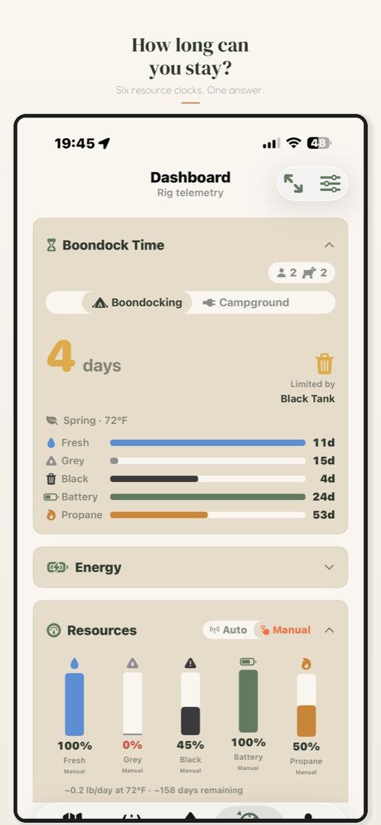
Boondock Time
Five clocks run at once (water, energy, propane, waste, and the legal stay limit) and the app names which one sends you to town first. It starts from your rig profile and calibrates as sensor data flows in.
Live sensor monitoring
Pairs directly with Mopeka, SeeLevel, Victron, Ruuvi, and Epoch or SOK battery BMS units over Bluetooth. No hub, no signal required.
Cloud integrations
Victron VRM and Peplink extend the picture to solar controllers, inverters, and connectivity. Starlink sky view is scored for any coordinate before you commit to the drive in.
Public-land maps
BLM, USFS, NPS, state, and Corps of Engineers boundaries on the map, with 5,500+ dispersed spots and a community spot database.
Rig-fit ratings
Every site checked against your rig's dimensions (green, yellow, red, or no-go) across 100K+ campgrounds, with community road-difficulty ratings from 1–7.
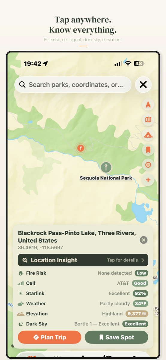
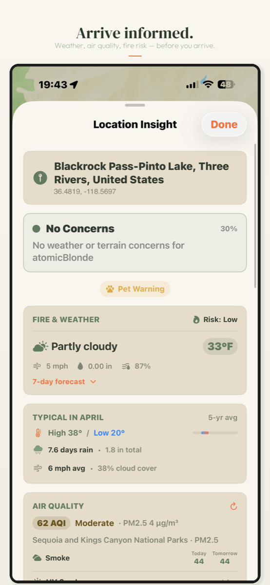
Location Insight
Cell coverage, fire restrictions, weather, bug pressure, and dark-sky quality for any spot — before you drive there, not after.
RV-safe routing
Routing that accounts for bridge clearances, road grades, and your exact dimensions, with a fuel planner that understands towing economy. Offline maps keep you oriented without service.
Solar Compass & Dark Sky
Four solar compass modes, including an AR overlay for panel placement, and a nightly 0–100 sky score built from Bortle class, moon phase, and cloud cover.